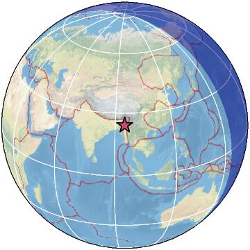
| Magnitude | 5.1 |
| Region | MYANMAR-INDIA BORDER REGION |
| Date time | 2025-03-18 07:49:00.6 UTC |
| Location | 24.367 ; 94.844 |
| Depth | 112 km |
| Distance | 103 km ESE of Imphāl, India / pop: 223,000 / local time: 13:19:00.6 2025-03-18 92 km NNE of Mawlaik, Myanmar / pop: 44,500 / local time: 14:19:00.6 2025-03-18 |
Source parameters reviewed by a seismologist
All data providers for this event:
Badan Meteorologi, Klimatologi dan Geofisika -- Jakarta, Indonesia (BMKG)GeoForschungsZentrum (GFZ) -- Potsdam, Germany (GFZ)
India Meteorological Department, New Delhi, India -- New Delhi, India (NDI)
National Earthquake Information Center, U.S. Geological Survey -- Golden, United States (NEIC)
EMSC -- Arpajon, France (SC4)
Further information can be found at:
India Meteorological Department, New Delhi, India -- New Delhi, India (NDI)National Earthquake Information Center, U.S. Geological Survey -- Golden, United States (NEIC)
GeoForschungsZentrum (GFZ) -- Potsdam, Germany (GFZ)