| Magnitude | 4.1 |
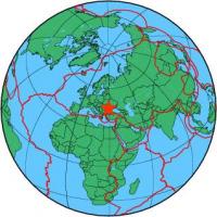
| Region | UKRAINE-ROMANIA BORDER REGION |
| Date time | 2013-03-02 03:38:20.2 UTC |
| Location | 45.035 ; 29.301 |
| Depth | 8 km |
| Distance | 107 km E of Brăila, Romania / pop: 213,000 / local time: 05:38:20.2 2013-03-02 18 km E of Mahmudia, Romania / pop: 4,800 / local time: 05:38:20.2 2013-03-02 |
All data providers for this event:
National Institute for Earth Physics -- Bucharest, Romania (NIEP)Seismological Survey of Serbia -- Belgrade, Serbia (BEO)
GeoForschungsZentrum (GFZ) -- Potsdam, Germany (GFZ)
National Institute in Geophysics, Geodesy and Geography - BAS -- Sofia, Bulgaria (SOF)
Geophysical Survey of the Russian Academy of Sciences -- Obninsk, Russia (GSRAS)
Further information can be found at:
Ukrainian NDC, Main Center of Special Monitoring -- Kyiv, Ukraine (MCSM)Carpathian Seismological Department, Ukraine Academy of Science -- Lviv, Ukraine (LVV)
Geophysical Survey of the Russian Academy of Sciences -- Obninsk, Russia (GSRAS)
National Institute for Earth Physics -- Bucharest, Romania (NIEP)
Institute of Geophysics and Geology -- Chisinau, Moldova (MOLD)