| Magnitude | 6.6 |
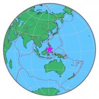
| Region | MORO GULF, MINDANAO, PHILIPPINES |
| Date time | 2014-12-02 05:11:32.6 UTC |
| Location | 6.200 ; 123.183 |
| Depth | 633 km |
| Distance | 146 km ESE of Zamboanga, Philippines / pop: 457,000 / local time: 13:11:32.6 2014-12-02 104 km WSW of Kalamansig, Philippines / pop: 12,800 / local time: 13:11:32.6 2014-12-02 |
All data providers for this event:
Instituto Geografico Nacional -- Madrid, Spain (IGN)National Institute for Earth Physics -- Bucharest, Romania (NIEP)
GeoForschungsZentrum (GFZ) -- Potsdam, Germany (GFZ)
Inst. de Astron., Geof. e Ciencias Atmos., Univ. de S?o Paulo, Brazil -- , Brazil (VAO)
Norwegian Seismic Array -- Kjeller, Norway (NORSAR)
HUN-REN EPSS Kövesligethy Radó Seismological Observato -- Budapest, Hungary (BUD)
Republican Seismic Survey Center or Azerbaijan National Academy of Sciences -- Baku, Azerbaijan (RSSC)
British Geological Survey (Global Network) -- Edinburgh, United Kingdom (BGSG)
Geophysical Survey of the Russian Academy of Sciences -- Obninsk, Russia (GSRAS)
National Earthquake Information Center, U.S. Geological Survey -- Golden, United States (NEIC)
Further information can be found at:
National Earthquake Information Center, U.S. Geological Survey -- Golden, United States (NEIC)Philippine Inst. of Volcanology and Seismology, Quezon City, Philippines -- Manila, Philippines (PIVS)
GeoForschungsZentrum (GFZ) -- Potsdam, Germany (GFZ)
Badan Meteorologi, Klimatologi dan Geofisika -- Jakarta, Indonesia (BMKG)